Mät en byggnad, en vägg eller ett takfall med din Geo. Öppna filen i GeoVision 360 och få volym, fasadarea, takytor och lutning – med en 3D-modell du kan vrida, kontrollera och rapportera. Measure a building, a wall or a roof slope with your Geo. Open the file in GeoVision 360 and get volume, facade area, roof planes and slope – with a 3D model you can rotate, check and report.
FunktionerFeatures
GeoVision 360 är byggt för objekt med plana ytor – hus, ekonomibyggnader, väggar, plank och tak. Samma Geo-filer som i Stockpile360, men beräkningar för plana ytor.GeoVision 360 is built for objects with planar surfaces – houses, farm buildings, walls, fences and roofs. The same Geo files as in Stockpile360, but calculations for planar surfaces.
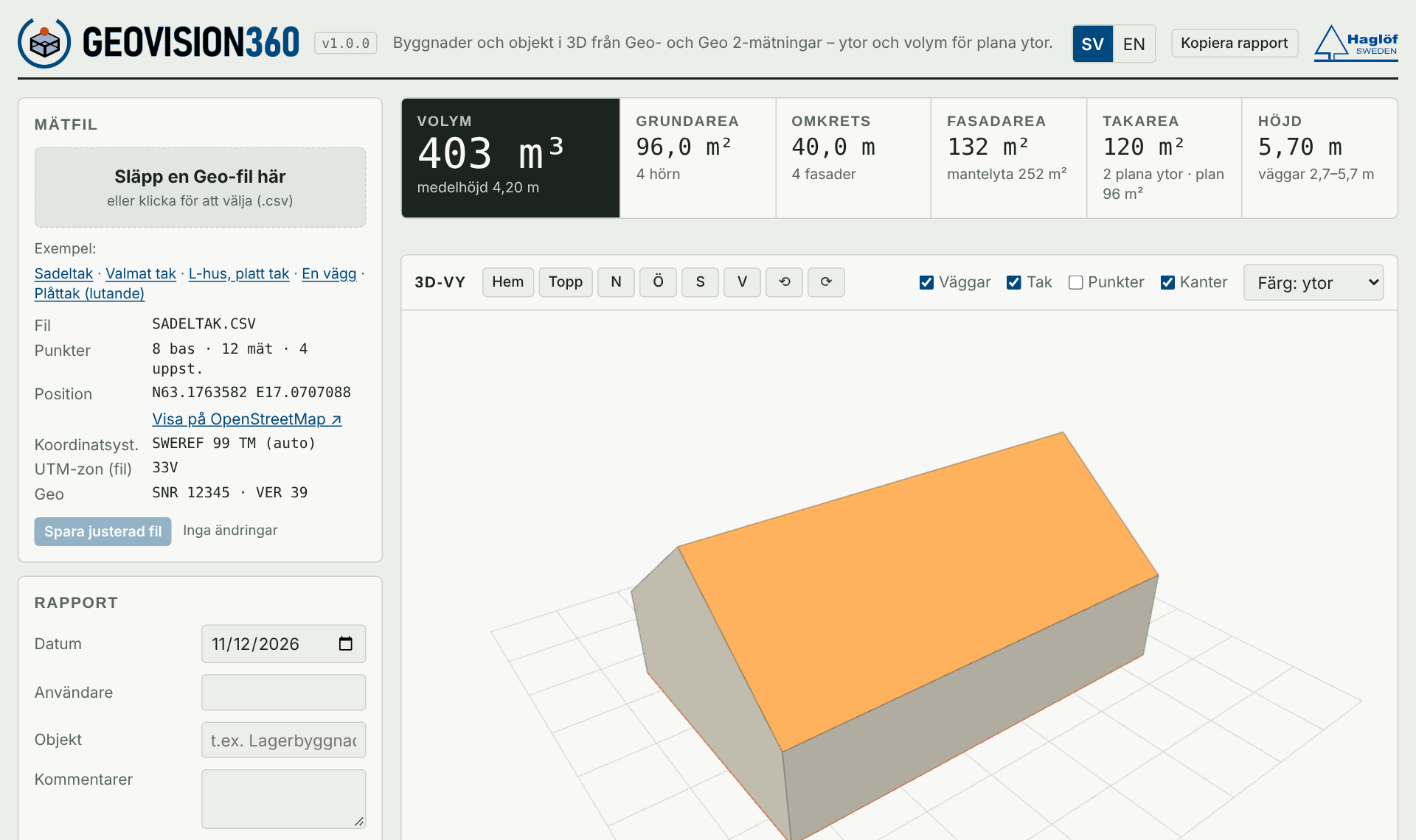
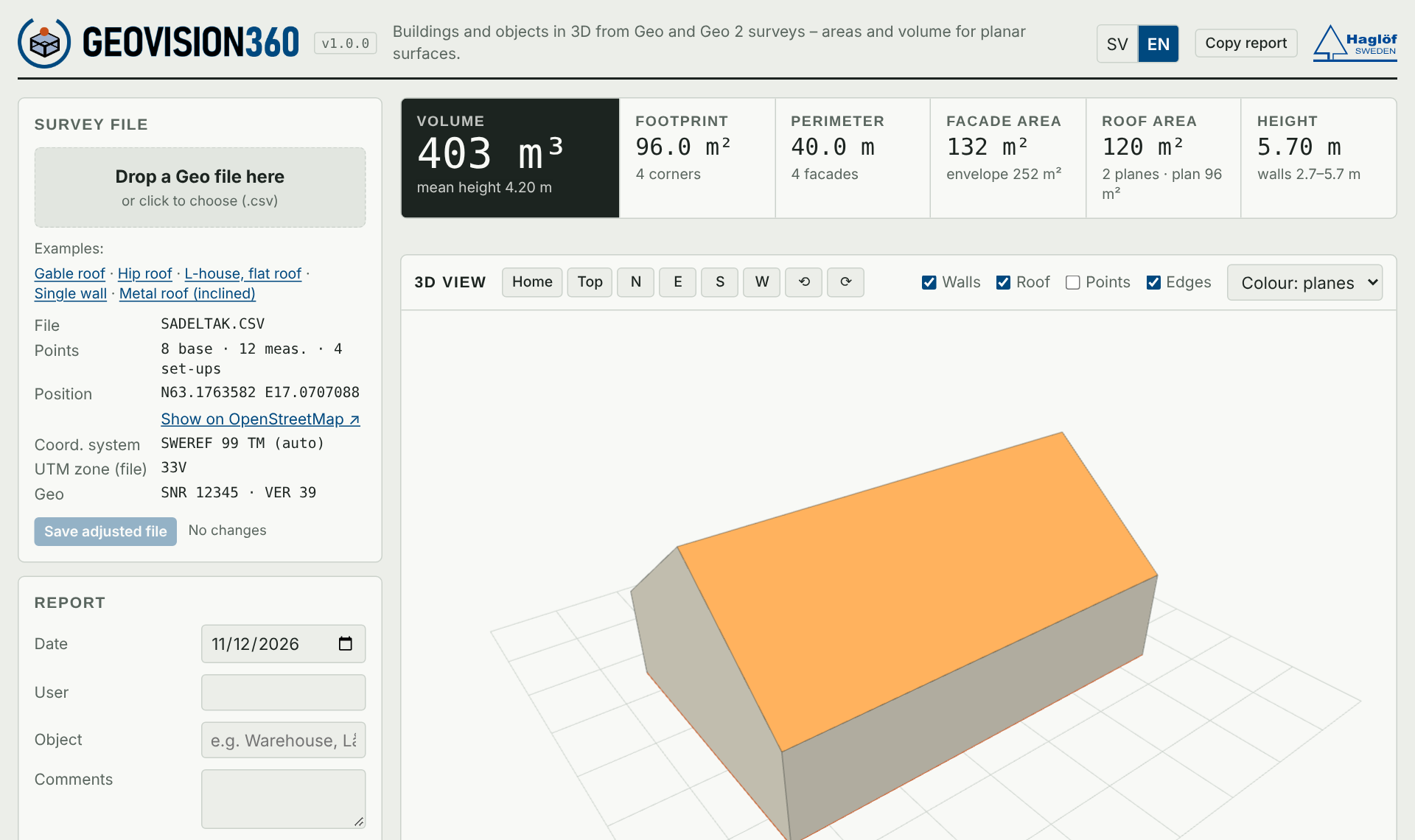
Volym, grundarea, omkrets, fasadarea per fasad, takarea per takyta och höjder – räknat direkt när filen öppnas.Volume, footprint, perimeter, facade area per facade, roof area per plane and heights – calculated the moment the file opens.
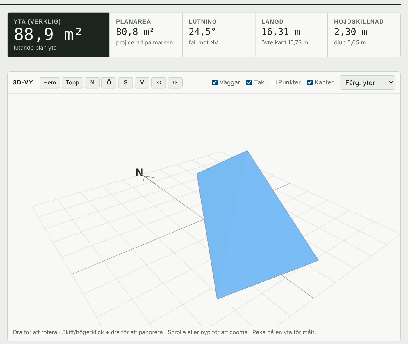
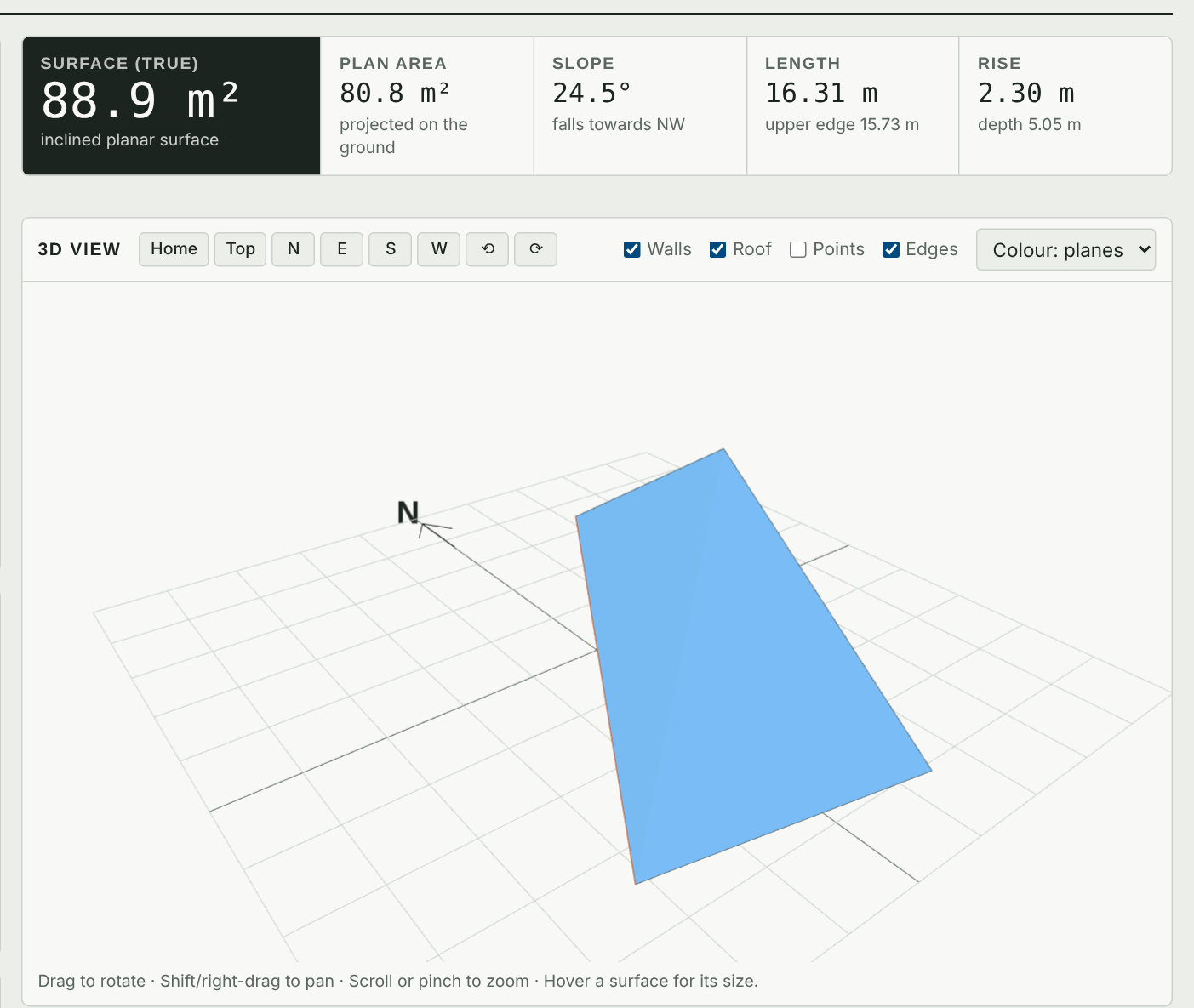
Mät takfoten och övre kanten – få verklig takyta, planarea, lutning och fallriktning. Perfekt för plåt- och takmaterial.Measure the eave and the upper edge – get true roof area, plan area, slope and fall direction. Perfect for sheet metal and roofing.
Vrid modellen i 3D, granska den ovanifrån och se alla fasader utvikta i en och samma vy.Rotate the model in 3D, inspect it from above and see every facade unrolled in one view.
Klicka på en punkt för att exkludera den eller byta typ. Filtrera punkttyper och se resultatet räknas om direkt.Click a point to exclude it or change its type. Filter point types and watch the result update instantly.
PDF-rapport med 3D-bild, plan, fasader och tabeller. GeoJSON till GIS. Textrapport att klistra in i mejlet.PDF report with 3D image, plan, facades and tables. GeoJSON for GIS. A text report to paste into an e-mail.
Koordinatsystemet känns igen automatiskt – UTM, WGS 84 och nationella system. Ett klick visar objektet på OpenStreetMap.The coordinate system is detected automatically – UTM, WGS 84 and national systems. One click shows the object on OpenStreetMap.
Så funkar detHow it works
Du mäter som vanligt. Baspunkterna beskriver objektets bas, mätpunkterna resten av formen – GeoVision 360 gör resten.You survey as usual. The base points describe the base of the object, the measurement points the rest of the shape – GeoVision 360 does the rest.
Mät hörnen nere vid marken som baspunkter (BASE) och väggkrön, takhörn och nock som mätpunkter.Measure the corners at ground level as base points (BASE) and wall tops, roof corners and ridge as measurement points.
Dra Geo-filen till GeoVision 360. Appen känner själv igen om det är en byggnad, en vägg eller ett takfall.Drag the Geo file into GeoVision 360. The app recognises by itself whether it is a building, a wall or a roof slope.
Kontrollera modellen, rätta vid behov och skapa en PDF-rapport eller GeoJSON-fil.Check the model, correct if needed and create a PDF report or GeoJSON file.
Baspunkter runt huset + krön och tak → volym, fasader och takytor.Base points around the house + tops and roof → volume, facades and roof planes.
Två baspunkter + två krönpunkter → väggarea, längd och höjd.Two base points + two top points → wall area, length and height.
Två punkter vid takfoten + två vid övre kanten → takyta och lutning.Two points at the eave + two at the upper edge → roof area and slope.
TakfallRoof slopes
Stå på marken, mät takfoten och övre kanten. GeoVision 360 ser själv att det är ett lutande tak och räknar ut:Stand on the ground, measure the eave and the upper edge. GeoVision 360 sees by itself that it is an inclined roof and calculates:
KontrollQuality control
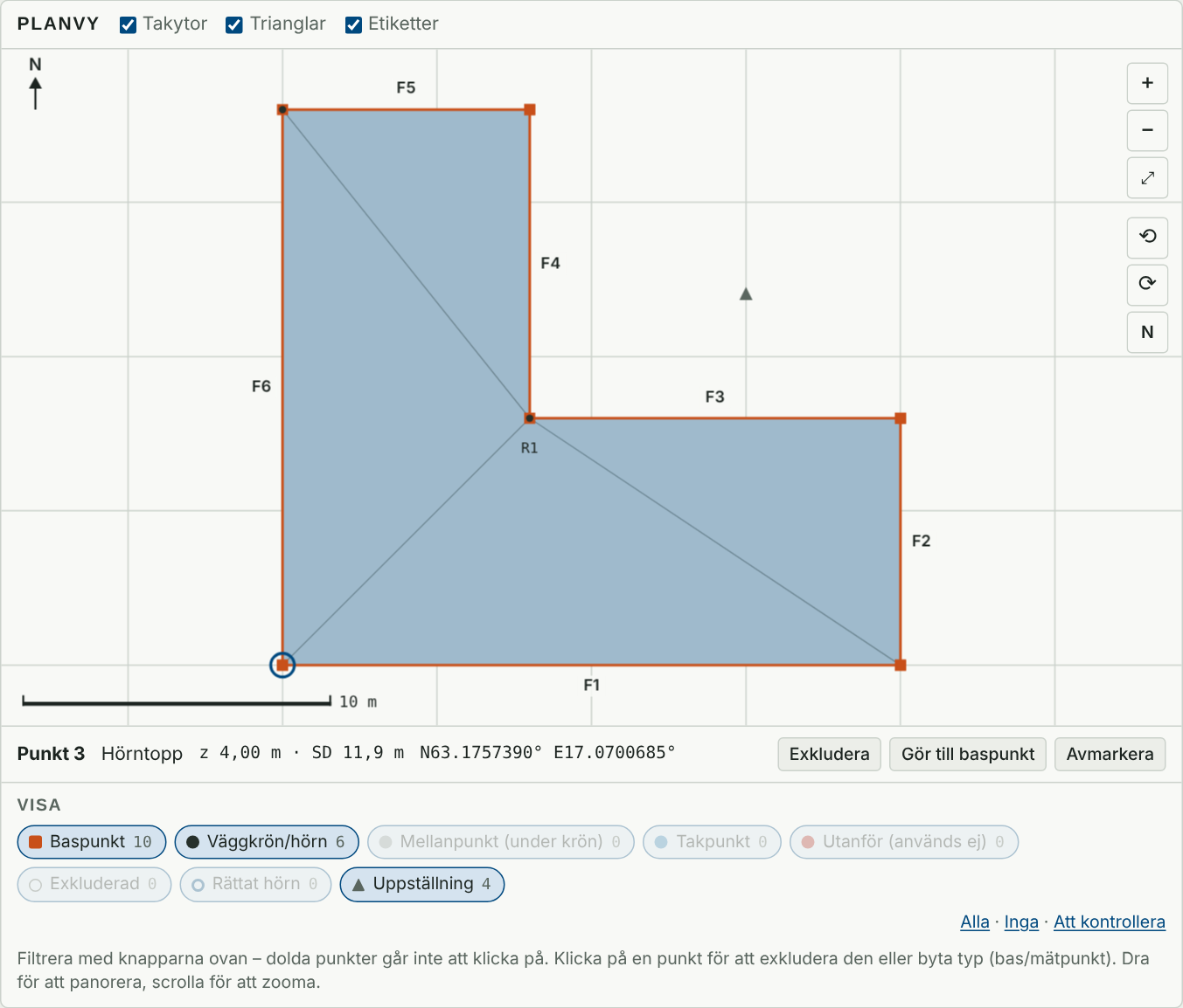
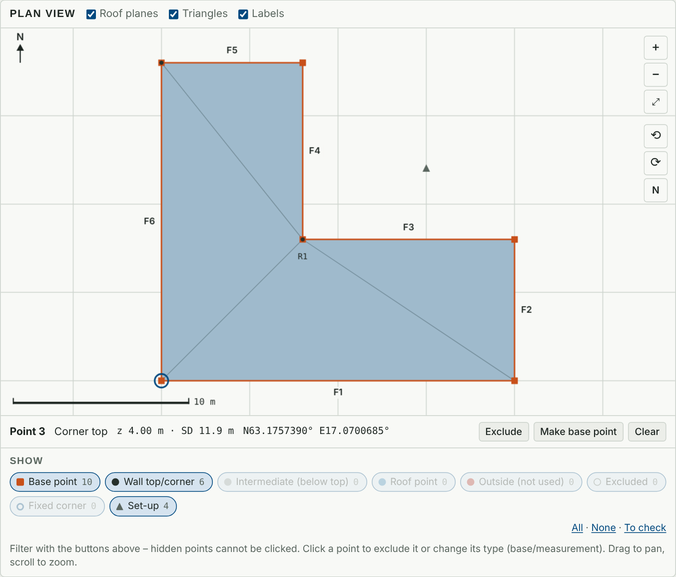
Planvyn visar basen, takytorna och alla mätpunkter. Hörn som mätts olika från två uppställningar rättas automatiskt, och du ser exakt vad som ändrats.The plan view shows the base, the roof planes and every measured point. Corners measured differently from two set-ups are fixed automatically, and you see exactly what changed.
FasaderFacades
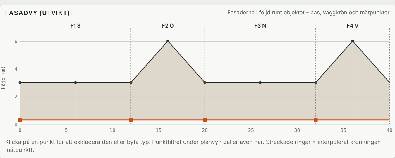
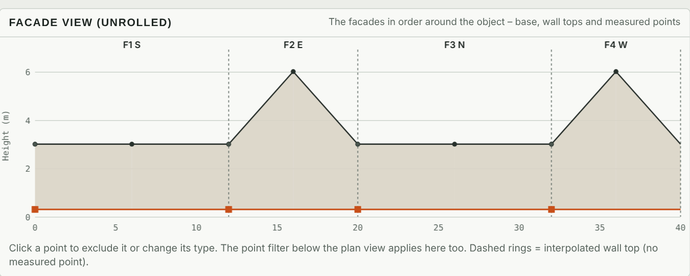
Fasadvyn viker ut väggarna runt hela objektet. Fasadarea, längd och höjd per väderstreck – underlaget för målning, puts eller isolering.The facade view unfolds the walls around the whole object. Facade area, length and height per compass direction – the basis for painting, rendering or insulation.
För vemWho it's for
Snabba mått utan stege, ritningar eller dyra instrument – med Geo i handen.Quick measurements without ladders, drawings or expensive instruments – with a Geo in your hand.
Takytor och lutning för material och offert – plåt, papp och takpannor.Roof areas and pitch for materials and quotes – sheet metal, felt and tiles.
Fasadarea per väderstreck för målning, puts, panel och isolering.Facade area per direction for painting, rendering, cladding and insulation.
Volym, grundarea och dokumentation av byggnader – med rapport och karta.Volume, footprint and documentation of buildings – with report and map.
Ladugårdar, lador och ekonomibyggnader – mät utan att klättra.Barns, sheds and farm buildings – measure without climbing.
Det här får duWhat you get
3D-bild, plan, fasader, tabeller och karta.3D image, plan, facades, tables and map.
Bas, fasader, takytor och punkter i WGS 84.Base, facades, roof planes and points in WGS 84.
Med dina rättningar – originalet orört.With your corrections – the original untouched.
Objektets position på OpenStreetMap.The object's position on OpenStreetMap.
Öppna appen och dra in en Geo-fil – eller börja med ett av exemplen. Inget konto, ingen installation.Open the app and drag in a Geo file – or start with one of the examples. No account, no installation.

